
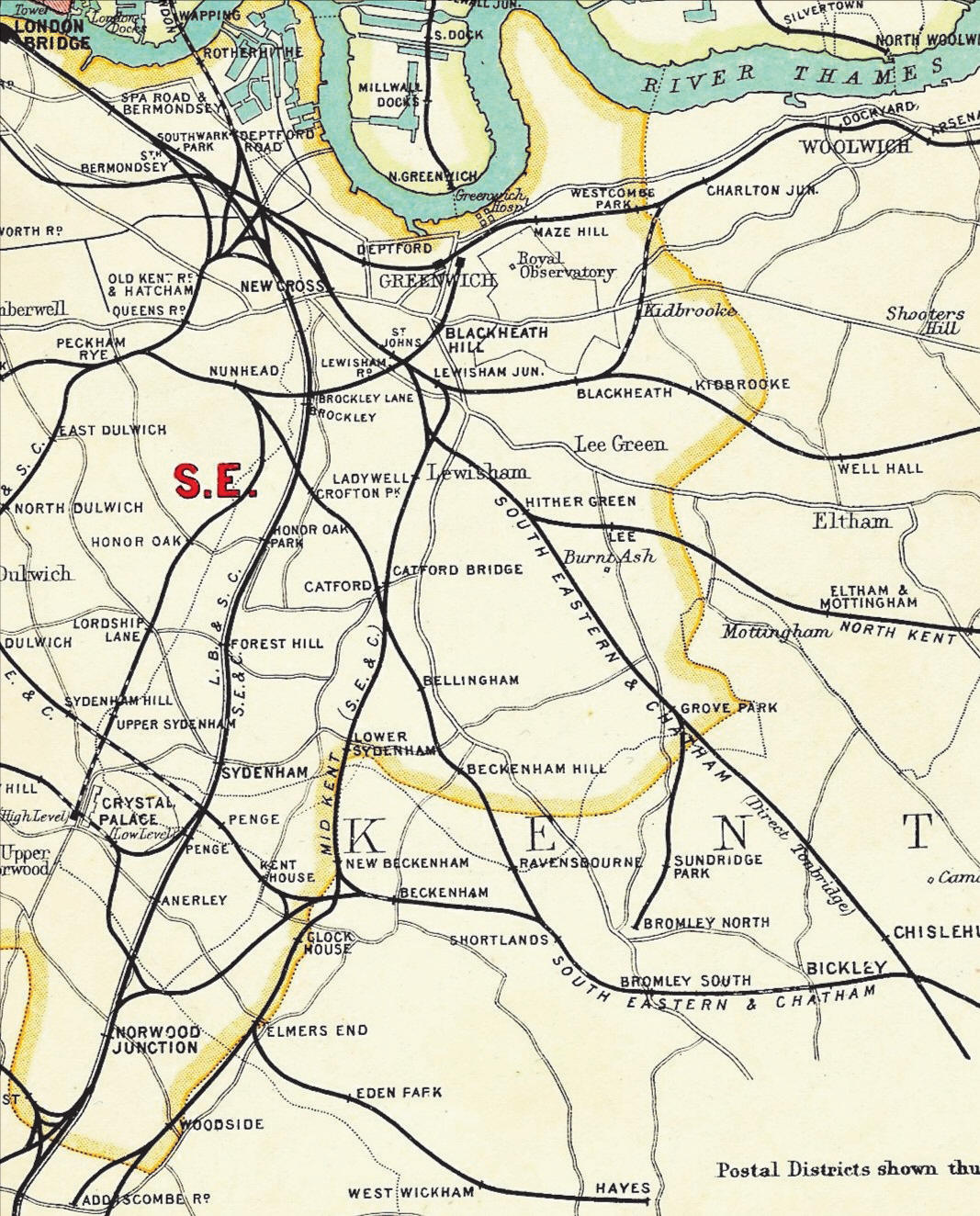
THE FINAL NETWORK
By the turn of the twentieth century the railway network had reached what proved to be its final and most complex form as shown in this 1908 map.
Some lines shown here have since closed or been re-routed.
New lines since this map is the Elizabeth Line, the Docklands Light Railway link under the Thames from the Isle of Dogs to Lewisham and the Channel Tunnel Rail Link.
 |
MAIN LINES
Modern Map
The map below shows the combined network as it is today, with construction dates for each line.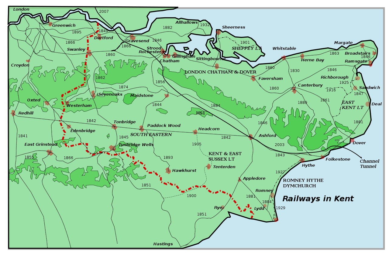
One legacy of the complicated and acrimonious relationship between companies building lines in Kent is the considerable number of alternative routes available to modern train operating companies in times of route blockages or planned engineering works.